Despite its small size, Bahrain hosts a number of valuable ecosystems, all of which have contributed towards defining Bahrain’s identity. Many of these are of great cultural significance having influenced the root of what is known today as Bahrain’s cultural and natural heritage.
Terrestrial Ecosystems
Inland Waters
Wetlands are a major part of the foundation of water resources, which are vital to the health of water pathways and downstream communities. Wetlands are home to various fish and wildlife species in addition to playing a huge role in trapping floodwaters, recharging groundwater supplies and removing pollution. Wetlands include swamps and marshes whilst varying widely due to differences in soils, topography, climate, hydrology, water chemistry, accompanied by other factors. It is important to note that some wetlands have apparent connection to surface waters like rivers, lakes or the ocean but have critical groundwater connections. Bahrain hosts various wetland sites most notably Tubli Bay and Dohat Arad. The Convention on Wetlands was adopted on the 2nd of February 1971, in the Iranian City of Ramsar in order to protect, conserve and sustain wetlands. There are over 2000 Ramsar sites worldwide, two of which are in Bahrain (Tubli Bay and Hawar Islands). Ramsar sites are those of international significance in terms of the biodiversity and uniqueness of their ecology, botany, zoology, limnology or hydrology.
Freshwater Springs
Freshwater springs are a unique class of aquatic ecosystems, which are known to have watered the northern and western areas of the island of Bahrain for centuries. These water springs have thus formed the most biologically diverse inland water ecosystem in Bahrain. They are known to have been powered by groundwater obtained from the Dammam aquifer, which is a large transboundary groundwater system that extends from central Saudi Arabia (which is where its main recharge area is located and where it crops out) to the Arabian Gulf waters, including Bahrain, Kuwait, southern Qatar, UAE and Oman (Bahrain’s Second National Report to the UNFCCC, 2012. pdf).
Freshwater ecosystems are known for the good quality of their waters which provides the basis for a diverse assemblage of aquatic flora and fauna whose productivity is primarily determined by light availability and secondarily affected by the availability of macro and micro nutrients and by the ambient groundwater temperature.
Unfortunately, the majority of the freshwater springs in Bahrain have died-out as a result of over-exploitation of underground water. The biological status of Bahrain’s famous freshwater springs condition has been classified as critical although all freshwater springs within the sea (the country’s name translates to “two seas” referring to the rare mix of freshwater that erupt in the middle of the sea) are said to have become extinct whilst the few remaining inland springs no longer have the ability to pump their water naturally.
Reed Swamps
Reed swamps (also known as reed beds) are natural and rare habitats in Bahrain that can be found in low-lying areas such as Lawzi Lake, Wadi Al Buhair and Ras Abu Jarjoor. They are known to support a high number of invertebrates and bird species, with vegetation stands ranging from very dense to open.
Reed swamps are also classified as wetlands which attract rare avifauna species like Tachybaptus ruficllis and Podiceps cristatus in addition to different types of brackish water species. Reed swamps’ conditions in Bahrain have been majorly affected by groundwater exploitation, urbanization and pollution. Thus, the total area of some of these swamps has decreased such as those present in the Janabiya area whilst others are facing issues related to degrading water quality e.g. in Wadi Al Buhair.
Agricultural Lands (also known as Palm Groves)
Once known to be the island of a million palm trees with the local saying that one can see a palm tree from anywhere a person stands on the island, the northern and western coastal areas are known for their fertile soil. For thousands of years, agricultural lands have been heavily cultivated with date palms and alfalfa plantations. Date palm farms are considered to be the most diverse terrestrial habitat on the island as it supports a variety of introduced and native species, including vascular plants, algae, insects, brackish water, fish and amphibians in addition to resident and migratory birds.
A sharp decline in the total area of date palm farms has been noted due to the rapid urbanization of the northern part of the main island. Freshwater springs are recorded to have been highly productive whereby they irrigated the palms groves through flooding, however since freshwater springs have now vanished, these groves require surface irrigation whereas in areas suffering from water scarcity, these groves are now said to be desiccated.
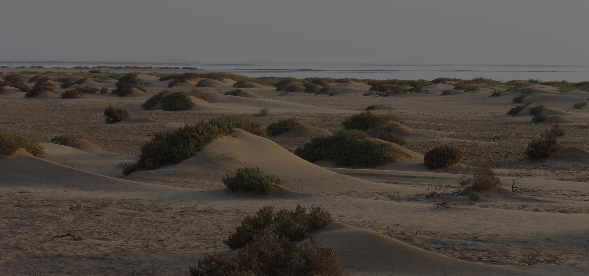
Desert Habitats
Bahrain is located in the global desert belt, and hence, its terrestrial landscape is predominated by desert habitats, which covers a considerable geographical area of all its islands. Deserts are arid regions, which are characterised by their lack of rainfall and high evaporation rates. Flora and fauna in this habitat are usually very well adapted to conserving water and surviving harsh conditions. In Bahrain, although during the summer the desert might look barren, it quickly springs to life following rainfall replacing its empty look with green landscapes. The deserts may appear to have little life in them but a closer look can reveal high biodiversity. Bahrain’s desert is said to host around 307 flora species of which 38% of them are native to the Arabian Desert (Kuhnji, 2008).
Marine Ecosystems
Bahrain enjoys a wide range of marine habitats despite its harsh physical marine environment. These marine habitats include rocky shores, mudflats, mangrove swamps, sandy beaches and sub-tidal habitats such as sea grass beds, mudflats and coral reefs.
Coral Reefs
Coral reefs are one of the most diverse ecosystems on the planet and are said to home about one-third of all marine fish species. Coral reefs are made up of corals, which secrete calcium carbonate thereby creating the reef’s structures. Coral reefs are said to have been very abundant in Bahrain covering many areas near and offshore. However, due to extreme conditions such as high salinity and temperature levels accompanied by intensive dredging and reclamation, coral reefs have been facing massive pressures. In 1998, Bahrain lost more than 90% of its coral as a result of a bleaching event, which affected most of Bahrain’s reefs. Thus, today, the status of coral reefs is very critical with structures of live coral scattered in patches at several reefs located in various areas such as Fasht Al Adhm, Reef Bul Thamah and Hayr Shtayyah.
Seagrass Beds
Seagrass beds are known to be of significant environmental and socio-economic importance hosting one of the most diverse key coastal habitats in Bahrain. Seagrass beds are noted to be widespread in the northern and eastern coastal areas and are known to provide forging and protection grounds for some threatened species such as sea cows (Dugong dugon) and the green turtle (Chelonia mydas). Furthermore, seagrass beds serve as a feeding ground for several commercial species such as rabbitfish locally known as “Safi” (Siganus canaliculatus), and a nursery area for the commercial prawn (Penaeus semisulcatus) and as well as a refuge area for a high density of pearl oyster spats (Pinctada radiata).
Oyster Beds
Oyster beds (locally known as Hayrat) are located all around Bahrain’s territorial waters with particular density found in the northern areas. The oyster beds are characterized by rocky surfaces covered by a thin layer of sand and an accumulation of pearl oyster shells forming the foundation of this ecosystem which hosts a diverse community of fish species, sponges, scattered corals and other benthic organisms. Oyster beds in Bahrain are of historical, cultural and economical significance due to its connection with Bahrain’s pearling industry, which was the main cause of Bahrain’s thriving economy prior to the discovery of oil.
Mangroves
Mangroves are unique trees that live in the coastal intertidal zone, hence they appear to be standing on water. They grow in areas with low-oxygen soil, where slow-moving waters allow fine sediments to accumulate which makes them excellent natural carbon sinks.
There are about 80 different species of mangrove tree species worldwide of which only one – the black mangrove (Avicennia marina) – can be found in Bahrain. This is due to its ability to tolerate the harsh climate and high salinity. In 2009, it was estimated that the total area of mangroves in Bahrain have shrunk to 80 hectares, 50 hectares of which can be found in Ras-Sanad Nature Reserve with the remaining 40 hectares being distributed around Tubli Bay stretching between Sitra and Al Aker. Mangrove habitats in Bahrain are critically threatened due to human activities and reclamation. In 2013, Bahrain started a mangrove-replanting program in each of Tubli Bay and Dohat Arad led by the Supreme Council for Environment in collaboration with the Directorate of Agricultural Affairs and Marine Resources in an effort to restore and conserve mangrove habitats.
Mangroves are of extreme value to islands such as Bahrain, as they stabilise the coastline, reduce erosion from storm surges, currents, waves and tides in addition to providing protection to fish and other organisms seeking food and shelter from predators. Moreover, they act as carbon sinks hence contributing towards mitigating climate change.
Coastal Habitats
Coastal habitats are classified as those above the mean water level in non-tidal waters or those above the spring high tide limit. These habitats are close to the sea and include rocky and sandy shores, beaches, cliffs and supralittoral habitats. Coastal habitats are said to account for approximately 30% of all marine biological productivity. In Bahrain, classical rocky shores (characterised by solid rock forming boulders, rock pools and cliffs) formed by extensive limestone cliffs are found along some of the islands coastlines such as in Umm Hazwarah and Al-Wakurs in Hawar islands (Bahrain’s First National Report to the CBD, 2006. pdf).
On the other hand, classical sandy beaches (characterised by loose deposits of sand, gravel or shells covering the shoreline) can only be found in islands located in the south and south-west from the main island and some offshore islands such as Mashtan Island.
However, a combination of sand and rock habitat formed by a rocky substrate covered with sand veneer is seen to be the most dominant coastal habitat found in Bahrain covering both intertidal and sub-tidal areas. It is important to note that, due to increased human activities accompanied by extensive dredging and reclamation activities, the majority of intertidal habitat types in Bahrain, especially those found along the northern and northeastern coastline have been modified in the last 10-15 years due to active coastal development.
Mudflats
Mudflats, also known as tidal flats, are formed when mud is deposited as a result of tidal actions. Classified as coastal wetlands, mudflats are usually found in sheltered areas such as bays, lagoons and estuaries and hence, in Bahrain the distribution of mudflats is found in low-energy sheltered areas such as Tubli bay.
Bahrain’s mudflats are well known for being high primary productive grounds, thus providing valuable feeding grounds for different types of resident and migratory seabirds including various species of fish and invertebrates. This can be observed in the mudflats and mangrove swamps in Tubli Bay and the northern coastline areas.
Sabkhas
Locally the word “Sabkhah ” refers to the flat, salt-crusted desert areas. Due to its high salinity level and inability to support vegetation, only microscopic bacteria and algae can be found on the soil surface of this type of habitat. There are two types of sabkhas found in Bahrain: Coastal Sabkahs and Inland Sabkahs. Unfortunately, due to rapid urban development, the sabkha habitats in Bahrain are being degraded by infilling and fragmentation activities.
Information Sources and References
- Bahrain’s First National Report to the Convention on Biological Diversity (2006) Public Commission for the Protection of Marine Resources, Environment and Wildlife. General Directorate for Environment and Wildlife Protection, Kingdom of Bahrain. (Bahrain’s First National Report to the CBD, 2006. pdf).
- Bahrain’s Fourth National Report to the Convention on Biological Diversity (2011) Public Commission for the Protection of Marine Resources, Environment and Wildlife. General Directorate for Environment and Wildlife Protection, Kingdom of Bahrain.
- Bahrain’s Second Communication’s Report to the UN Framework Convention on Climate Change (2012) Supreme Council for Environment, Kingdom of Bahrain (Bahrain’s Second National Report to the UNFCCC, 2012).